
















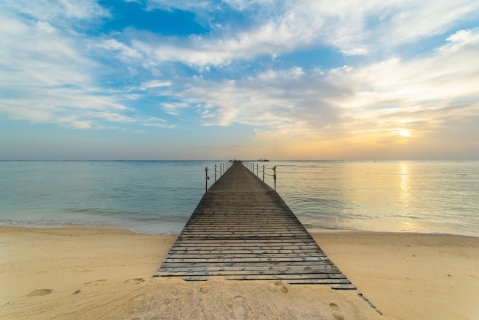
 Where to Go for Christmas: Sun, Value and Fewer Crowds
Where can you find warm Christmas weather without peak-season prices and huge crowds? Compare Marsa Alam, The Gambia, Vietnam, Agadir and Cap Skirring.
This page shows both the average monthly rainfall and the number of rainy days in Port Ghalib, Red Sea, Egypt. Long-term data from 1990 to 2020 was used to calculate these averages. Now, let's explore all the details to give you a full picture.
Port Ghalib sits in an arid zone with minimal moisture, averaging 26 mm (1 in) of rainfall per year.
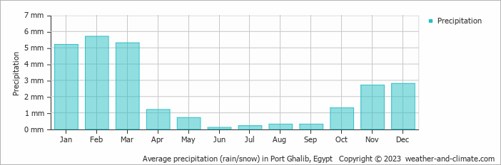
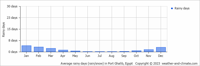
Precipitation levels in Port Ghalib remain relatively steady throughout the year. February has the most rain, with 5.7 mm (0.2 in) over 3 days. In June, this drops slightly to 0.1 mm (0 in), making the city's climate fairly predictable.
February, the wettest month, has a maximum daytime temperature of 22°C (72°F). The city receives 238 hours of sunshine in this period. During the driest month June you can expect a temperature of 36°C (97°F). For more detailed insights into the city's temperatures, visit our Port Ghalib Temperature page.
Browse day-by-day precipitation records for Port Ghalib spanning 51 years. Select any month and year to see actual rainfall and snowfall recorded on each day.
The map below shows the annual precipitation across Egypt. You can also select the different months in case you are interested in a specific month.
Port Ghalib's average annual precipitation is 26 mm (1 in). Let's compare this to some popular worldwide tourist destinations:
The climate in San Francisco, USA, is influenced by coastal weather, with 469 mm (18 in) of rainfall mostly during the winter months.
In Shanghai, China, the annual average precipitation is 1347 mm (53 in), with a humid subtropical climate.
In Tokyo, Japan, the average annual precipitation is 1528 mm (60 in), with significant summer rains due to typhoon season.
Ho Chi Minh City, Vietnam, receives 1955 mm (77 in) of annual rainfall, with a pronounced wet season from May to November, typical of its tropical monsoon climate.
Precipitation amounts are measured using specific gauges installed at weather stations, collecting both rain and snow and any other type of precipitation. Rainfall is measured directly in millimeters, while that from snow and ice is obtained by melting it. Automated systems often incorporate heaters to make this easier.
Information from these stations is transmitted via Wi-Fi, satellite, GPS, or telephone connections to central monitoring networks. This information is immediately updated and integrated into weather models and forecasts.
Precipitation has a very strong role in determining the local climate and ecosystem:
For more detailed information about Port Ghalib's weather, including sunshine hours, humidity levels, and temperature data, visit our Port Ghalib Climate page.
Pick a month to see the average temperature, rainfall and sunshine in Port Ghalib - and find the best time to visit.
Temperature Rainfall Sunshine Humidity Wind Speed
See the full Port Ghalib climate overview or explore weather in Egypt.
Where to go in October - average daytime high across popular destinations.
Need travel inspiration? Check out our bucket list articles and be inspired.
Where to Go for Christmas: Sun, Value and Fewer Crowds
Where can you find warm Christmas weather without peak-season prices and huge crowds? Compare Marsa Alam, The Gambia, Vietnam, Agadir and Cap Skirring.
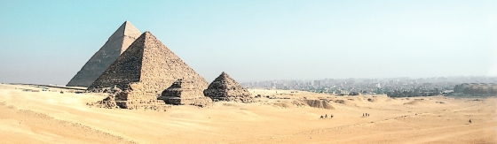 The Pyramids of Giza are impressive and absolutely worth a visit
The pyramids are considered to be one of the seven wonders of the world in ancient times and they are the only one that still exist and can be visited today.
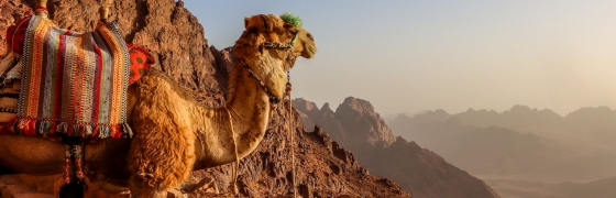 The Sinai Peninsula: Nowhere on earth is as quiet as this place
The Sinai Peninsula has an extraordinary and enchanting landscape. The peace and space in this region is overwhelming. Nowhere on earth is as quiet as this place.
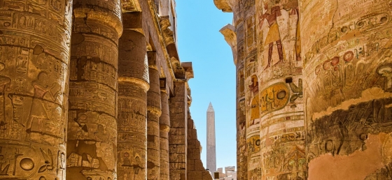 The Timeless Wonders of Luxor
Discover Luxor’s ancient marvels, from the grand Karnak temple and royal tombs of Thebes to the historic charm of the Old Winter Palace.