

















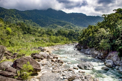
 Pico Bonito: Honduras' enchanting jungle adventure awaits
Explore Pico Bonito, Honduras' largest national park. Discover diverse wildlife, exhilarating activities, and lush landscapes. Your jungle adventure begins here!
This page shows both the average monthly rainfall and the number of rainy days in Puerto Cortes, Honduras. Long-term data from 1990 to 2020 was used to calculate these averages. Now, let's break down all the details for a clearer picture.
Puerto Cortes experiences significant rainfall throughout the year, averaging 2500 mm (98 in) of precipitation annually. However, this abundant rainfall is not evenly distributed, with a distinct rainy season during certain months. You can clearly see this in our monthly precipitation graphs below.
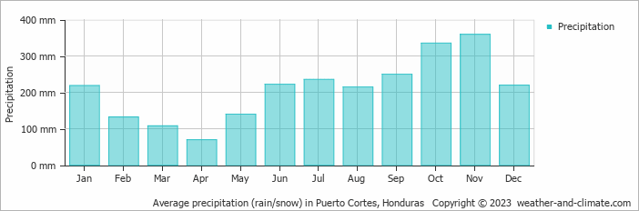
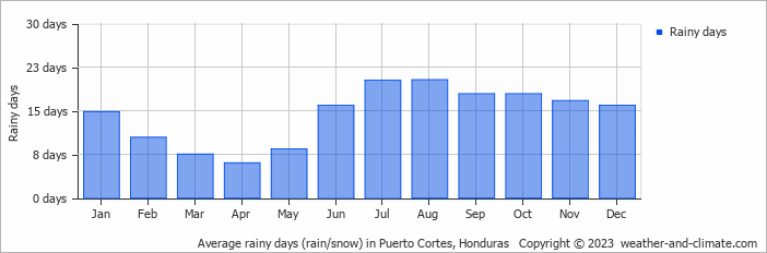
The seasons in Puerto Cortes, bring significant changes in precipitation. The wettest month, November, receives heavy rainfall, with an average of 359 mm (14 in) of precipitation. This rainfall is distributed across 17 rainy days.
In contrast, the driest month, April, experiences much less rainfall, totaling 69 mm (2.7 in) over 6 rainy days. These distinct seasonal differences provide diverse experiences throughout the year.November, the wettest month, has a maximum daytime temperature of 28°C (82°F). The city receives 156 hours of sunshine in this period. During the driest month April you can expect a temperature of 30°C (86°F). For more detailed insights into the city's temperatures, visit our Puerto Cortes Temperature page.
Average daily rainfall for each day of the month based on long-term records. 47-year average (1977-2025)
Browse day-by-day precipitation records for Puerto Cortes spanning 51 years. Select any month and year to see actual rainfall and snowfall recorded on each day.
The map below shows the annual precipitation across Honduras. You can also select the different months in case you are interested in a specific month.
Puerto Cortes's average annual precipitation is 2500 mm (98 in). Let's compare this to some popular worldwide tourist destinations:
The climate in San Francisco, USA, is influenced by coastal weather, with 469 mm (18 in) of rainfall mostly during the winter months.
In Shanghai, China, the annual average precipitation is 1347 mm (53 in), with a humid subtropical climate.
In Tokyo, Japan, the average annual precipitation is 1528 mm (60 in), with significant summer rains due to typhoon season.
Kuala Lumpur, Malaysia, receives 2529 mm (100 in) of annual rainfall, characteristic of its equatorial tropical rainforest climate, with consistent rainfall throughout the year and peak months during March and November.
Precipitation amounts are measured using specific gauges installed at weather stations, collecting both rain and snow and any other type of precipitation. Rainfall is measured directly in millimeters, while that from snow and ice is obtained by melting it. Automated systems often incorporate heaters to make this easier.
Information from these stations is transmitted via Wi-Fi, satellite, GPS, or telephone connections to central monitoring networks. This information is immediately updated and integrated into weather models and forecasts.
For more detailed information about Puerto Cortes's weather, including sunshine hours, humidity levels, and temperature data, visit our Puerto Cortes Climate page.
Pick a month to see the average temperature, rainfall and sunshine in Puerto Cortes - and find the best time to visit.
Temperature Rainfall Sunshine Humidity
See the full Puerto Cortes climate overview or explore weather in Honduras.
Where to go in October - average daytime high across popular destinations.
San Pedro Sula 30°C (86°F) Utila29°C (84°F) Roatán29°C (84°F) West End29°C (84°F) West Bay29°C (84°F) Tegucigalpa27°C (81°F) Copán Ruinas27°C (81°F) La Ceiba28°C (82°F)
 Need travel inspiration? Check out our bucket list articles and be inspired.
Pico Bonito: Honduras' enchanting jungle adventure awaits
Explore Pico Bonito, Honduras' largest national park. Discover diverse wildlife, exhilarating activities, and lush landscapes. Your jungle adventure begins here!
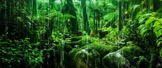
 The top 5 unexplored rainforests in Central America
Dive into Central America's top 5 hidden rainforests for an unparalleled journey through vibrant wildlife and diverse landscapes.
 The unspoiled Bahía Islands in Honduras
Discover Roatán, the largest of the Bahía Islands, a paradise for divers and snorkelers with stunning reefs and wildlife. Best visited February to July.
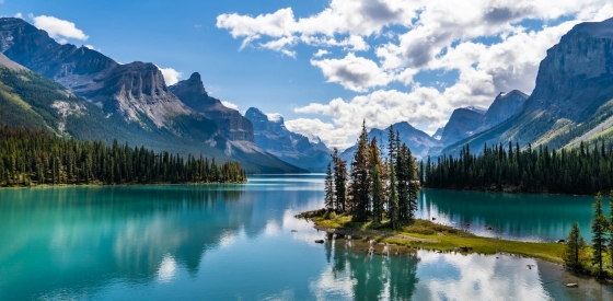
 The 5 most beautiful lakes in Canada
Explore Canada's stunning lakes: Lake Louise, Lake Superior, Maligne Lake, Emerald Lake, and Lake Okanagan, each offering unique beauty and activities.